A Guide to Walking Tinto Hill
Tinto is the hill everyone in Upper Clydesdale grows up with. It’s visible for miles, it’s climbed year round, and it’s about ten minutes’ drive from Littlegill’s front door. If you’re staying with us and you only do one walk, this is the one.
Here’s what to expect before you set off.
The hill in brief
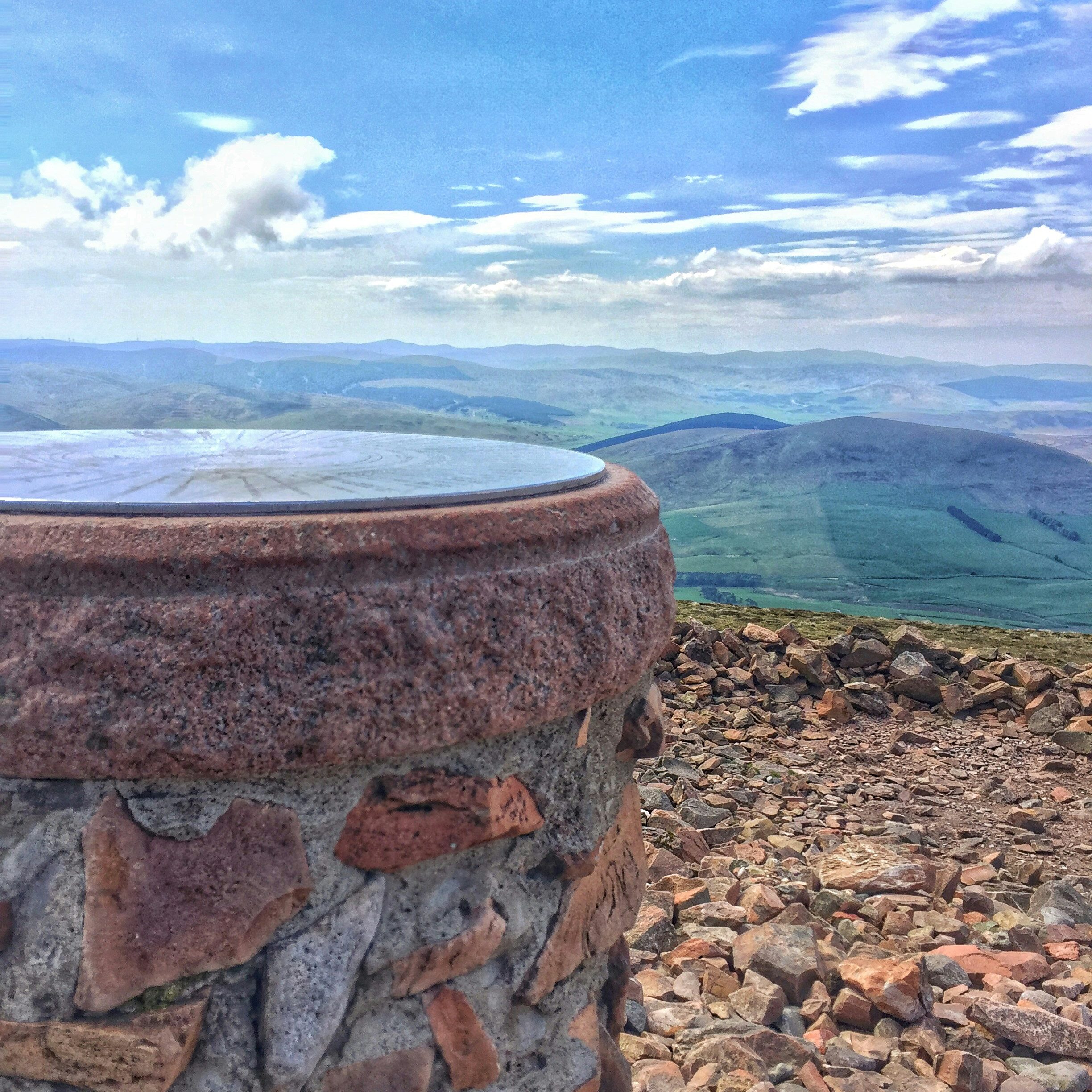
Tinto stands at 711 metres, or 2,334 feet, measured at the summit cairn. The Ordnance Survey trig point sits slightly lower at 707 metres, which explains the two heights you’ll see quoted. Its isolation is the point: nothing nearby comes close in height, so the views open out across a very large slice of southern Scotland. Undiscovered Scotland notes that on a clear day you can pick out Skiddaw in the Lake District and Lochnagar in the Cairngorms.
The summit cairn is worth a moment on its own. It’s Bronze Age, roughly 45 metres across, and reckoned to be the largest of its kind in Scotland.
Where to park
Use the Tinto Hill car park at Fallburn, just off the A73 between Symington and Thankerton. It sits a short way down a minor road, immediately past a cattle grid. Postcodes for rural spots like this can be approximate, so it’s worth checking the location on a map before you leave rather than trusting the sat nav alone.
The car park is small and it fills up on fine weekends and bank holidays. An early start solves this and rewards you with a quieter path.
The route
Navigation is genuinely simple. From the information board, a single wide track heads south and continues all the way to the top.
The first stretch runs gently between fences, under power lines, and out onto open hillside. Look to your right here for the grassed-over ramparts of Fallburn hillfort, an Iron Age fort with beautifully preserved concentric rings that are easier to make out from higher up the path.
The track then steepens for a long pull up Totherin Hill, a northern shoulder of the main summit. The cairn at the top of Totherin marks roughly halfway. Beyond it the path forks a couple of times. Both branches rejoin near the top, though keeping left avoids the craggier ground. A final stiff climb alongside a fence line brings you to the summit cairn.
You return the same way. Tinto doesn’t lend itself to a neat circular route, which is part of why it’s such a popular quick outing.
- Distance, ascent and how long it takes
- Distance: around 4.2 miles there and back
- Ascent: roughly 480 metres, or about 1,570 feet
- Typical time: two and a half to three and a half hours
Fit walkers get up in well under an hour. Families with young children should plan on the longer end and build in stops. The path is broad and obvious throughout, which makes it a good first proper hill.
What to wear and take
The one thing people underestimate is the surface. Much of the track is loose shale and stone, which is fine going up and unforgiving on the way down. Boots with a decent sole are worth having, and walking poles help tired knees on the descent.
The summit is exposed and reliably colder and windier than the car park, whatever the forecast says at the bottom. Take a windproof layer, gloves and something warm even in summer. Carry water and a snack, since there’s nothing on the hill itself.
Tinto is a well-known family climb and plenty of small legs make it to the top with enough encouragement and enough biscuits. The wide path means nobody needs to scramble. That said, it’s a sustained uphill effort rather than a stroll, so pick a settled day.
With children and dogs
In winter the picture changes. Snow and ice on the upper slopes can call for crampons and an ice axe, and conditions in the Southern Uplands shift quickly. Check a mountain forecast rather than a town forecast, and be willing to turn back.
This is working hill ground with sheep on it for much of the year, so dogs need to stay under close control. Look out for lambing signs in spring.
Afterwards
The Tinto Hill Tearoom sits close to the start of the path, which is about as well placed as a tearoom can be. If you’d rather push on, Biggar is fifteen minutes away and has a prize-winning chippy, cafés and an ice cream shop for a well-earned second course.
Staying nearby
Littlegill is one of the closest places to stay for Tinto, at about ten minutes from the Fallburn car park. Four bedrooms sleep seven, there’s space to dry boots and spread out, and full-fibre wifi for the evening afterwards. Our local area guide covers the other walks and days out within easy reach, including Culter Fell for anyone wanting something longer.
Planning a walking weekend? Check dates and book directly for the best rates.